Physical Address
304 North Cardinal St.
Dorchester Center, MA 02124
Physical Address
304 North Cardinal St.
Dorchester Center, MA 02124
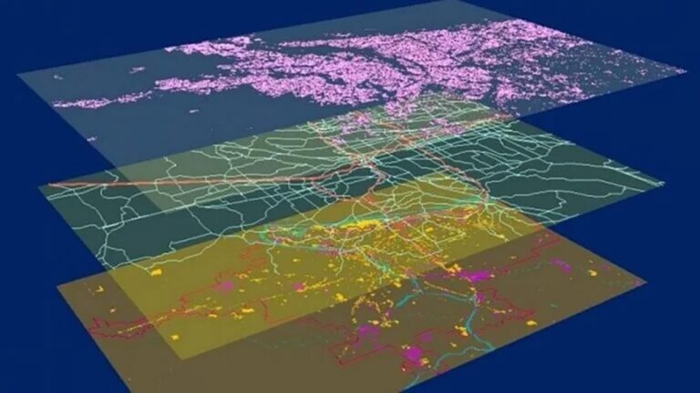
Data layering in GIS is a fundamental technique that enables the creation of rich, informative maps by combining multiple data sources. Whether you are overlaying drone imagery with cadastral parcel lines or combining geological maps with weather data, this article will offer you a comprehensive guide.

By integrating digital design with data management tools, Building Information Modeling (BIM) techniques and technologies are revolutionizing architecture, engineering and construction (AEC) design. This comprehensive guide will help you understand and implement BIM.
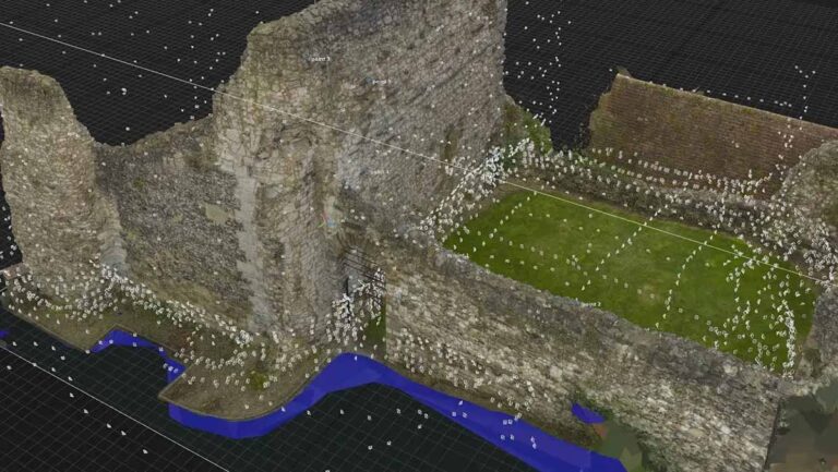
This article will introduce and guide you through the principles, technologies and workflows involved in photogrammetry, allowing you to create 3D models from a few photos.
An introduction to modern Geographic Information Systems (GIS) techniques, approaches and all the cutting edge GIS technologies.
Deep mapping, a rich-data mapping system which cross-correlate multiple data sources in order to understand the context, patterns, inner workings, history and evolution of a city.